Services
- Covid 19 Operational Services
- Community Development
- Community Services
- Construction Department
- Culture & Wildlife
- Department of Education
- Finance Department
- Fisheries
- Compliance and Risk Management
- Health and Wellness
- Human Resources
- Human Services
- Information Technology
- Muckleshoot Police Department
- Recreation Program
- Tribal Court
- Tribal Gaming
Geographic Information System
The Geographic Information System (GIS) Program for the Muckleshoot Indian Tribe is responsible for providing cartographic and analytical support for the Planning Division. The GIS Program also provides end-user support to other tribal programs such as: Realty, Public Works, Fisheries, Wildlife, Culture, Loan Program, Legal, and Construction. The program also provides special request services to the general membership and Tribal Council.
The Muckleshoot GIS Program houses over 1,000 different datasets on several GIS servers. This data is stored as either vector (e.g. street centerlines, parcel boundaries, topography, etc.) or raster (aerial imagery). The Tribe maintains data on a scale of 1:4,800 for areas within the external boundaries of the reservation and 1:24,000 for areas outside the tribal boundaries. The GIS program currently utilizes ArcGIS ArcInfo, ArcGIS ArcView, ArcSDE, and ArcGIS Server 9.x to manage and maintain the GIS data.
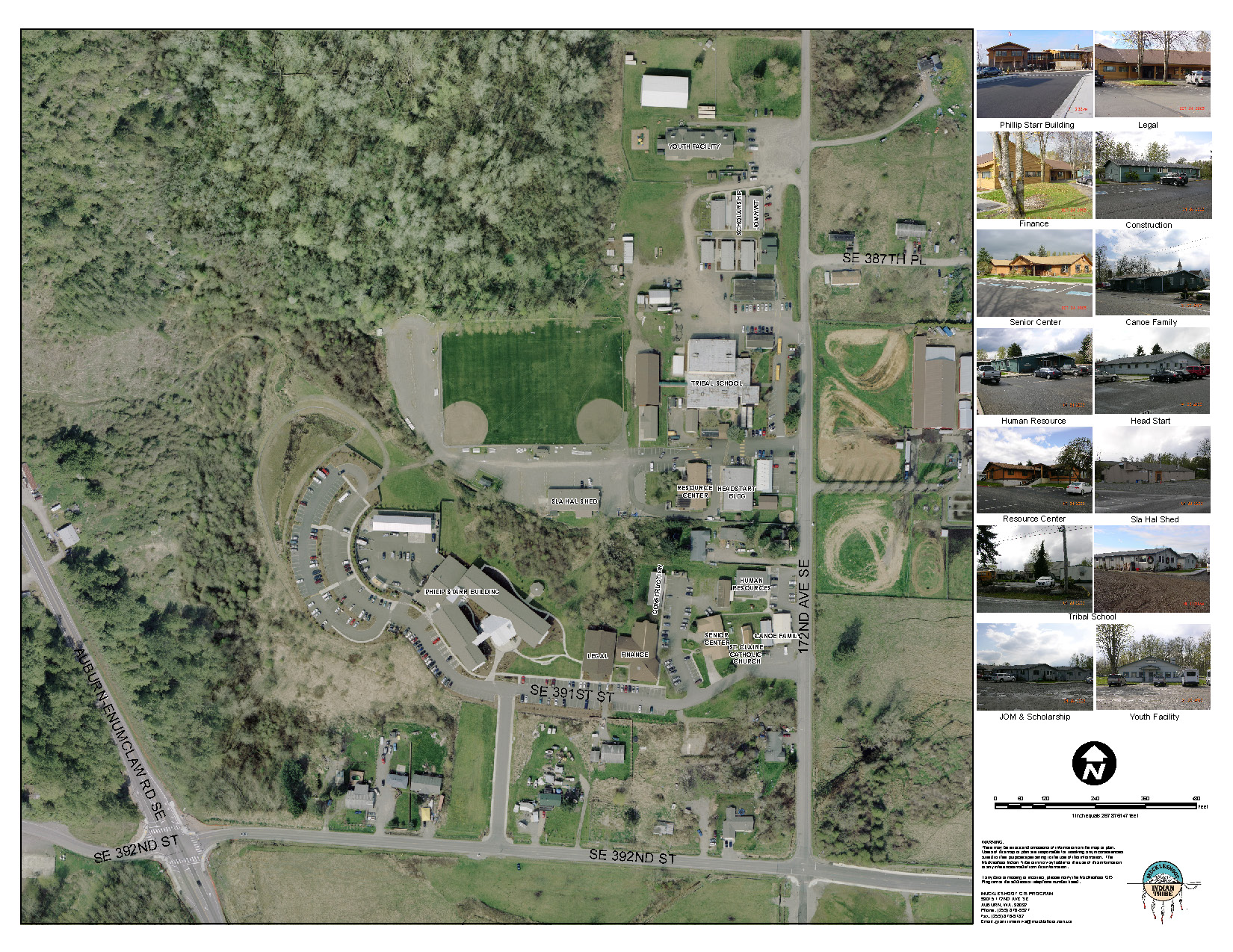
| Muckleshoot Campus Map |
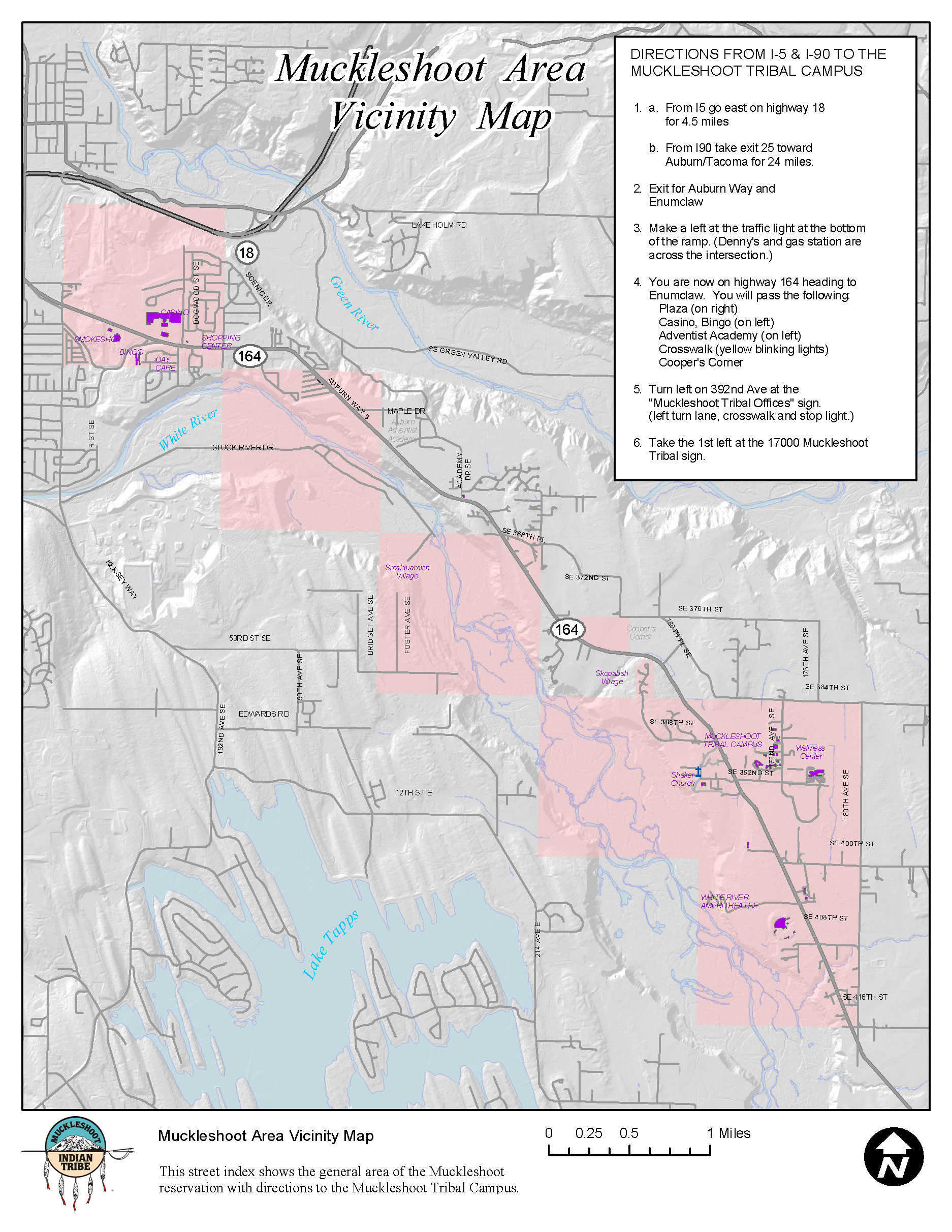
| Muckleshoot Vincinity Map |